

Ultima Thule
-
Posts
923 -
Joined
Content Type
Forums
Store
Blogs
Downloads
Events
Gallery
Posts posted by Ultima Thule
-
-
Also, what is the timing for Bus 15 and 15A? How often do they run?
!
http://aikataulut.hsl.fi/linjat/en/h15a.html
-
Is there is schedule I can get from somewhere with the bus times?
Here is the current timetable for bus 76 with times for four major stops. First table is for buses going North to South, second table for buses going South to North. Full list of stops at the end of table.
-
Hi -
Is there a ticket kiosk or tourist place on Gamla Stan than I can purchase a bus ticket for bus #76 to get back to Frihamnen?
Pressbyrån at Gamla stan subway station, Munkbrogatan 8
Pressbyrån, Västerlånggatan 19
Hjärtpunkten, Järntorget 83
-
Thank you very much. Is there more than one way on to the bus? I know a lot of buses have have a middle door. I just wondered which one would be easier with a wheelchair.
Read
http://sl.se/en/Visitor/Plan-your-journey/Accessibility/
and
also note this about wheelchairs: "You get to travel free of charge on most of our buses."
see:
-
Also, what is the name of the stop for the Vasa museum.
Its "Djurgårdsbron" (Djurgården bridge) and the stop names are in order:
Frihamnen
Frihamnsporten
Lindarängsvägen
Filmhuset
Oxenstiernsgatan
Radiohuset
Berwaldhallen
Djurgårdsbron
Does the driver call out the stop names?
Yes. And the general rule is, as soon as you can see the bay you should get off.
Here is a map of the bus lines:
http://sl.se/scripts/kartor-geografiska/7510.Innerstan.2011.html
-
Do you know of a catholic church close to Gamla Stan? We would like to attend a regular mass if possible.
.
Folkungagatan 46
Kungträdgårdsgatan 12
-
You will go from Frihamnen and the closest station to HRC is Underground Radmansgatan (exit library ). There you will also get info about the cost. Closest Underground to Frihamnen is Gardet. Approx 20min fast walk from the ship.
You'll have to change from the red to green line att subway station "T-Centralen" but the tracks on that station are laid out for just cases like this. Just walk to the opposite side of the platform to get to the correct train.
-
Hi
We will be taking the arlanda express from the airport to the central station in stockholm. We would like to take the Blue Bus #1 to Frihamnen pier/port to board the Vision of the Seas on a Saturday. Can we walk from central station to board the Bus #1 or do we need to take a connecting bus? We only have one carry-on each. Please give specifics re location of bus stop (cross streets), direction to walk in, etc.....THANKS!!!!
judy
The railway station-bus station complex is a rather complicated structure that I never really have investigated so I'm not sure exactly where you will exit.
From the old railway station building it would be some 450 yards walk to the bus stop. Turn left and follow Vasagatan northwards under the Klarabergsviadukten and past Mäster Samuelsgatan, Bryggargatan, and Gamla Brogatan. After Hotel Adlon you turn right into Kungsgatan and the bus stop is right there.
But I noticed on Google maps there is a exit in the new railway station building (or whatever it is called) with the sign "Arlanda Express" over it. If it is there you exit it is just about 300 yards to go. Go forward one block along Vasaplan and turn left into Vasagatan. Go past Gamla Brogatan. After Hotel Adlon you turn right into Kungsgatan and the bus stop is right there.
-
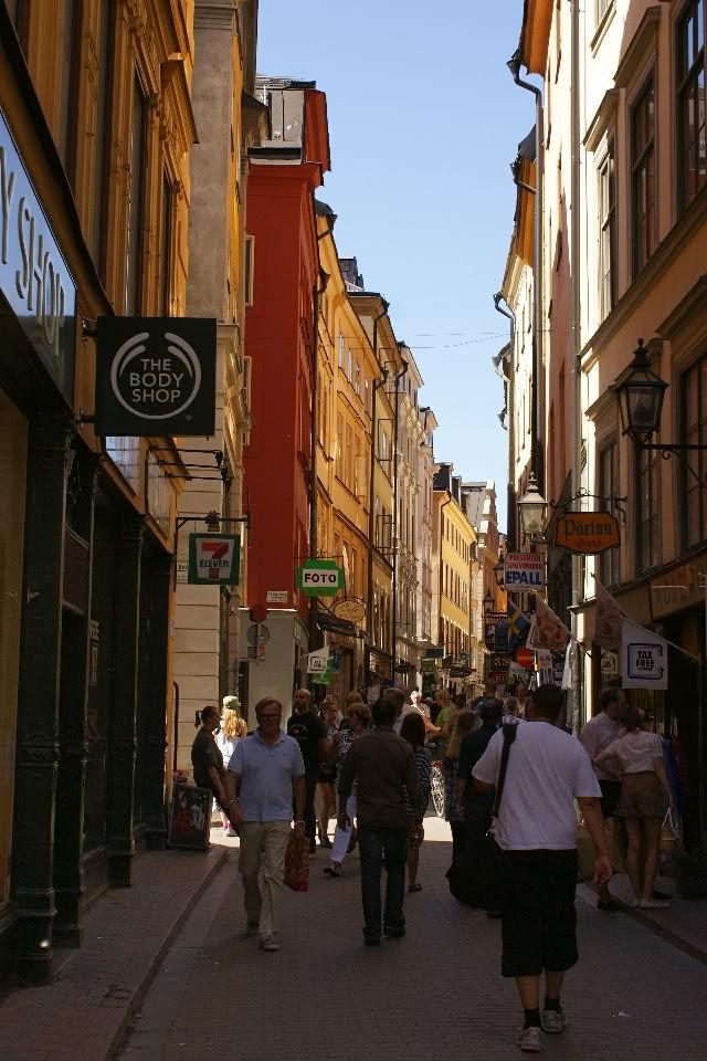
Is Gamla Stan cobblestones or uneven terrain?
Sorry to inform you that streets in Gamla Stan are almost completely made of cobblestones and that the terrain is a bit hilly too in some places. But on the major tourist street, "Västra Långgatan" the stones are of a modern, smooth type (see picture) and the street terrain is decently even too.
-
Walk past the Opera, past the park, turn left and a little bit up to the bus stop. Bus 76 will take you to Djurgården bridge. Walk over bridge and take first road to the right to reach Vasa.
But note that you cannot buy a ticket on the bus. You need to have one before getting in.
http://sl.se/scripts/kartor-geografiska/7510.Innerstan.2010.html
Just a clarification. You should take the bus going NORTH i.e the bus stop across the street (Kungsträdgårdsgatan) from the park.
-
Is there a city bus that passes both the Opera HOuse and VAsa Museum, or near both? I cannot seem to find a straight answer anywhere. My ship shuttle leaves me off at the Opera House, from which I want to go to the Vasa Museum. Thank you for your help.:confused:
Walk past the Opera, past the park, turn left and a little bit up to the bus stop. Bus 76 will take you to Djurgården bridge. Walk over bridge and take first road to the right to reach Vasa.
But note that you cannot buy a ticket on the bus. You need to have one before getting in.
http://sl.se/scripts/kartor-geografiska/7510.Innerstan.2010.html
-
Arriving at S167 STADSGÅRDEN at 08.00 22 Aug 11, departing 17.00
Interested in a concise itinerary to see the best of Stockholm [not particularly interested in the Vasa Museum, due to limited time]
Should we walk from the ship to the Old Town or take a HOHO boat or bus ? Keen on a photographic record of Stockholm
Thanks in advance - help much appreciated for this newbie
Its a bit hard to answer that kind of questions as there are to many options available. It would be easier if you gave some information about your interests and habits. Do you like to walk for example or do you prefer bus?
-
As a small comfort I can tell you the Island Sky quay position in Helsinki is ideal next to the Old Market Hall and a stone's throw to market square. No need to worry about bus transport or shuttles as most other cruise passengers have to.
-
Is it possible to walk from the Vasa Museum to City Hall? What about walking from City Hall to Gamla Stan? It is hard to tell on maps if that is just a bridge for cars or can pedestrians walk across safely. How long would each walk take? We walk about 3 miles per hour. It may be quicker to take a cab or HOHO boat.
There should be no technical difficulties doing the walk. There should be a pedestrian route along Tegelbacken-Stadshusbron bridge. Distance Vasa-City hall is about 1.7 miles =34 minutes. i should say 40 minutes to be on the safe side.
City hall to gamla Stan is back the same way you came and then over Vasabron bridge or through Helgeandsholmen island (you cannot walk on the Centralbron). Distance half a mile or 10-15 minutes.
Generally speaking you'll always be able to find some pedestian route in the city centers in the nordic countries.
-
it will take you as long to walk to Tallin from the edge of the pier as it takes to walk from the ship to the pier gates-it is very large!
And its a bit deceptive as the terrain is open after the harbour exit and the first town walls seems so close . In fact the walk from the quay all the way to the town hall is 2 km (1 1/4 miles) if you take the main road left of old town and then turn right along Viru.
-
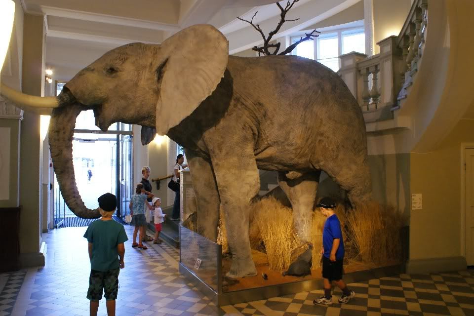
For Helsinki I should mention the Natural History Museum as an alternative.
http://www.luomus.fi/english/nhm/
It is newly open after a major rebuild, with several nice dioramas of animals from all over the world.
Its not an overwhelmingly big museum so it will not take too much time to see it.
Its located in downtown. You would pass it on the way to the rock church so it is easy reachable. Cost is 6/3 euros.
Its built to be child friendly with activities like open the box and see whats inside; add the correct bones to the incomplete skeleton on the wall:
open the kitchen cabinet doors and see giant models of insects etc.
The prehistoric section includes a skeleton (copy, not original) of Giganotosaurus Carolini, a carnivore dinosaur larger than even Tyrannosaurus Rex.
Audio tours in English: http://www.luomus.fi/english/nhm/tours/audio.htm
Note: closed on Mondays.


-
A question to the Swedes here (north-bound , Al etc)
When I last visited Stockholm ( a month ago) I received my 24h travel card in the form of the new reloadable SL Access card that I understand in the future will replace all other ticket types in Stockholm.
Now I read that, as most people have asked for new cards again and again instead of taking the trouble to reload their old ones, it has been decided that from 1 January 2011 the SL Access cards will cost 20 kr.
Does it mean that from now on tourists will have to pay an additional 20 kr for a total of 120 kr for a tourist card they probably will never use again?
-
On a cruise ship, dock at 9, leave at 5PM so only one day, trying to make max use of time.
thanks
Well, its rather hectic either way. Perhaps still best to try to do Vasa as early as possible to "get rid of it" so to say. ;) Just keep control of the time.
-
Ultima;
Therefore you would suggest take my time and then after 1:00 go to Vasa, will it be less crowded?
thanks
I will not suggest one or the other as I don't even know how much time you got in the evening.. Don't know how you planned to go to Vasa in the morning either. I just had the feeling there is not much margin for unexpected delays it the first plan.
-
Advise Please;
I am doing an excursion starting at Gamla Stan @11;30 we will be docking at STADSGÅRDEN @ 09:00.
Do I go immediatly to Vasa, rush and get to Gamla Stan by 11;15
To be honest that sounds a bit stressful to me.
-
How far/long a walk is it from Glama Stan? appor time?
thanks
About 800 feet from southern end of Gamla Stan
-
Would anyone have any advice on what is the easiest way to get there?
never been there myself but it seems like bus #1 from Frihamnen, stepping off at Mariebergsgatan would be the obvious chose. .
-
And for Helsinki you find the information here:
-
First, it should have been easier to give answer if you should have mentioned date and time interval.
I'm so sorry to say that regarding the above bus 76 schedule I don't understand any of the words (stops??). What is the word I am looking for (on the left) regarding the stop close/near to Frihamnen port? All these words are very unknown to my American knowledge of Sweden..Ok, that table showed only the times for the four major stops along the route Ropsten (start) Kungsträdgården, Slussen, Ljusteögatan (end station ). The full list of all stops were on page 5.
Anyway, there seems to to be lists on the Net for all individual stops as well (I wasnt aware of that yesterday). Here is the one for bus 76 stop Frihamnen towards downtown:
http://sl.se/hpltid/ihtt/sommar/001/out/00100442.pdf
So first bus passes Frihamnen at 6:38 Monday to Friday (Måndag-Fredag), then 6:58, 7:18, 7.34 and so on. First bus on Saturday (Lördag) passes at 9:06 and there is no traffic on Sunday.
I don't know about the ferry either. I see the word Djurg..... but not sure which one I am using. Thanks...but if anyone can just give me the answer I'd be so grateful.
I admit that table is messy. Ignore everything on the second page. On the left side of the first page are the tables From (Från) Djurgården to (till) Slussen .
Monday to Friday (Måndag till Fredag), Saturday (Lördag), Sunday and Holiday (Sön- och Helgdag). Traveltime Djurgården Slussen some 7-8 minutes.
Helsinki Questions? Glad to help!
in Northern Europe & Baltic Sea
Posted
Bus #16 goes straight from Hernesaari LHC and LHB to the Market Square.
http://aikataulut.hsl.fi/linjat/en/h16.html